Articles — About maps
Plant hardiness zones colouring map
About maps Special interest maps Teaching worksheets

Over a month ago, anticipating the nebulous arrival of spring, I started a plant hardiness zone colouring map. This was to add to the complement of colouring maps and mapping worksheets I'd been making.Alas, despite the best intentions of having it finished within a week, quarantine homeschooling has been absorbing every morsel of my time. I'm sure many of you can relate. As cartographer Daniel Huffman observed following a cartography live-stream event where women were under-represented, a probable cause was that women were otherwise occupied taking care of children, doing household tasks and homeschooling their kids as all the schools...
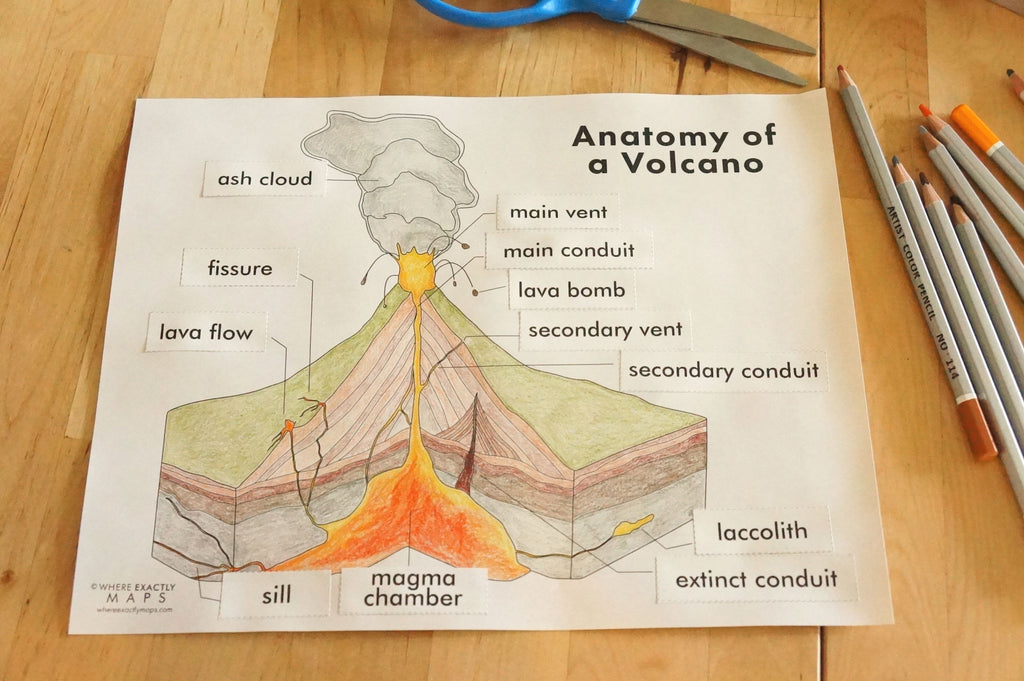
Volcano worksheet with detailed diagram and tectonic map
About maps Teaching worksheets

Our children love books. Reading has been a large part of their lives, even from their earliest days. There aren't many things more lovely than having a little cheek pressed against your own as you bring stories to life or witness their amazement at the incredible inner workings of a planet, the complete camouflage of a moth, or as in a recent instance, the fact that a single teaspoon of neutron star weighs more than the entire population of the whole world. This boggling fact comes from a Smithsonian book (published by DK) simply called Stars. It's part of a...
Tectonic plates map worksheet
About maps Teaching worksheets


Last week we made map colouring pages. This week, we're continuing the educational mapping worksheet idea with a scientific angle. What do earthquakes, volcanoes and mountains have in common? Indeed. They all exist or happen along the edges of tectonic plates. Tectonic plates are fascinating. They make up the entire crust of the earth, fitting together like a giant puzzle. These plates are continually moving, scraping against each other, spreading apart or colliding. Earth's geography changes as this movement creates new ocean floor, mountain ranges and active volcanoes. This printable worksheet has a map with all the tectonic plates...
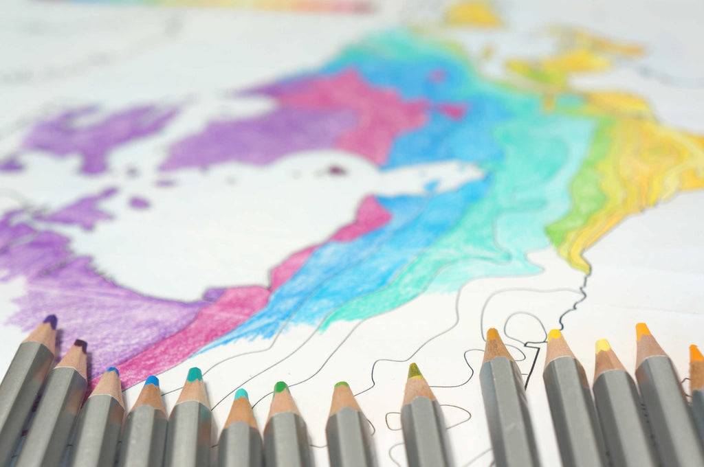
Map colouring pages for kids
About maps Teaching worksheets


In these uncertain days, many of us are spending a lot of time inside. It can be challenging to ward off boredom, keep children engaged and learning a bit of something. So in the spirit of having fun and learning at the same time, we've made a series of printable colouring maps! Each colouring map file has a blank map for colouring and labelling, a map guide with all countries labelled as well as their abbreviations and a list of different ideas for using the colouring maps in a variety of ways. Grab a copy of Europe , Canada ,...
The Anatomy of a Map


A map is composed of many layers of information, each displaying different geographic features. This is literal as well as figurative because at the very beginning of a map's creation, its spatial data is divided up into many separate files. The files are imported into mapping software where they are displayed in a layered fashion, one on top of the other. Layer order is important. To ensure the features display correctly, are not obliterated or overprinted, careful organization is necessary. There are two data types maps are made with: vector and raster. VECTOR: editable points, lines and areas all containing...